United States
 Argentina
  Australia
  Austria
  Brazil
  Canada
  Chile
Chile  Czechia
  France
  Germany
  Greece
  Italy
Italy  Mexico
  New Zealand
  Nigeria
  Norway
  Poland
  Portugal
  Sweden
  Switzerland
  United Kingdom
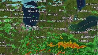
 Metro Detroit weather forecast: Snow expected this week

2 rounds of snow expected
DETROIT – Everything remains on track with our midweek winter storm.
Today will feature more clouds than sun but, hopefully, a bit of sun (can’t rule out some morning drizzle, but that’s not very impactful). Temperatures will hold steady in the mid 30s (2 degrees Celsius). North wind at 10 to 15 mph, with higher gusts over Lake Huron, will once again cause some shoreline issues as waves combined with the high lake levels crash ashore, causing minor flooding and beach erosion. Accordingly, the National Weather Service has issued a Lakeshore Flood Advisory for our Lake Huron shoreline areas until 4:00 a.m. Wednesday.
Today’s sunrise is at 7:44 a.m., and today’s sunset is at 5:51 p.m.
Mostly cloudy Tuesday night, with lows in the low to mid 20s (-6 to -5 degrees Celsius). North wind at 5 to 10 mph.
Mostly cloudy on Wednesday -- we’ll get through the day (including both rush hours) dry. Highs in the low 30s (0 degrees Celsius).
Wednesday night snow forecastSnow develops Wednesday night, with lows in the mid 20s (-4 degrees Celsius). It appears that we’ll have 3-4 inches of snow on the ground by Thursday morning. The one caveat about the snow forecast is that some models suggest a potential change to a wintry mix (chances increase as you approach the state line), and any changeover cuts into the snow accumulation.
This aspect of the forecast will need to be fine tuned as this storm comes into range of our higher resolution computer models -- we’ll keep you updated.
Snow Thursday morning should become lighter by afternoon. Highs in the low 30s (0 degrees Celsius). Another inch of accumulation is possible.
Another round of light snow Thursday night into Friday morning should drop another inch. Lows Thursday night in the mid 20s (-5 degrees Celsius), and highs Friday in the low 30s (0 degrees Celsius).
Snow should finally end by Friday afternoon.
Weekend outlookAt this point, the weekend looks mostly dry. We’ll likely see more clouds than sun, and seasonal highs in the low 30s (0 degrees Celsius) on Saturday, and the mid 30s (1 to 2 degrees Celsius) on Sunday.
Radar, alerts, school closings, appClickOnDetroit has you covered with:
Copyright 2020 by WDIV ClickOnDetroit - All rights reserved.

Local 4 meteorologist Paul Gross was born in Detroit and has spent his entire life and career right here in southeast Michigan. Paul has researched, written and produced eight half-hour documentaries for WDIV, as well as many science, historical and environmental stories.