United States
 Argentina
  Australia
  Austria
  Brazil
  Canada
  Chile
Chile  Czechia
  France
  Germany
  Greece
  Italy
Italy  Mexico
  New Zealand
  Nigeria
  Norway
  Poland
  Portugal
  Sweden
  Switzerland
  United Kingdom
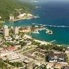
 Over 12 800 earthquakes hit Santorini-Amorgos zone in 10 days ...

More than 12 800 earthquakes have been recorded within the Santorini-Amorgos zone over the past ten days, as confirmed by the Interdisciplinary Committee for Risk and Crisis Management at the National and Kapodistrian University of Athens (EKPA).
In response, the Hellenic Red Cross (HRC) has mobilized rescue teams, social workers, and psychologists to assist affected residents. Volunteers equipped with rescue tools such as cutting equipment and ropes arrived on February 11.
The HRC’s Social Welfare Unit is prioritizing psychological support for vulnerable groups including the elderly, chronically ill individuals, and children experiencing distress from the ongoing seismic events. Teams have also been stationed at the Municipality of Thira’s Community Center in Mesaria to offer assistance to residents in Santorini.
The Seismology Laboratory at EKPA has been closely monitoring the seismic sequence, noting that 102 earthquakes occurred on February 9 alone. Among them, 14 had magnitudes above 4.0, and two exceeded M4.5. The strongest earthquake recorded during the period was M5.0, occurring at 21:05 LT (19:05 UTC).
On February 10, at 22:16 LT (20:16 UTC), an M5.3 earthquake struck off the coast of Santorini and Amorgos, marking the strongest event in the region so far. The epicenter was located 14 km (8.7 miles) south-southwest of Arkesini, Amorgos, at a depth of 17 km (10.56 miles), as confirmed by the Geodynamic Institute. The earthquake was felt in Attica and Crete.
An M5.0 earthquake was recorded 16 km (9.94 miles) south of Arkesini, at at 00:37 local time (22:37 UTC) on February 11 at a depth of 5 km (3.11 miles), followed seven minutes later by an M4.3 earthquake.
Greek seismologist Akis Tselentis added that the current seismic sequence could persist for months, drawing comparisons to the M6.0 Arkalochori earthquake in Crete which was preceded by four months of seismic buildup.
The swarm’s location suggests the potential involvement of the Kolumbos submarine volcano, located just 6.5 km (4 miles) northeast of Santorini. Kolumbo is part of the larger Santorini volcanic complex and is known for its major eruption in 1650, which caused damage and fatalities because of pyroclastic flows, tsunamis, and gas emissions.
The volcano remains active, with hydrothermal activity and periodic seismic swarms, making it a key focus for monitoring in the region. Investigations are underway to determine whether the seismicity is caused by tectonic stress along the Kolumbos and Kameni fault systems or deeper magmatic processes.
The increased seismic activity has triggered numerous landslides across Santorini affecting the natural and built environments. Geologists from EKPA’s Department of Geology and Geoenvironment have documented landslides within and beyond the caldera slopes, with impacts observed in the southern coastal areas, central-eastern caldera slopes, and northern regions of the island.
Red Beach and Vlychada Beach have been among the most affected locations, with debris accumulation altering the coastal landscape. Red Beach has remained inaccessible because of recurring rockfalls while Vlychada Beach has narrowed substantially because of unstable mass deposits.
Rockfalls have also been observed along the road between Oia and Fira, requiring careful navigation for vehicles. At the Athinios port, the extent of landslides has been limited, and no damage has been reported to port infrastructure or businesses.
In response to these developments, Civil Protection authorities have implemented preventive measures including restricting access to high-risk zones and closing sections of roads deemed unsafe. Structural intervention strategies tailored to Santorini’s volcanic topography will be considered once seismic activity subsides.
Professor Senol Hakan Kutoglu from Zonguldak Bulent Ecevit University in Turkey warned that an M8+ earthquake in the Aegean Sea could trigger tsunami waves between 3 and 5 m (9.84 and 16.4 feet) along Türkiye’s coastline.
As a result, the Turkish Disaster and Emergency Management Authority (AFAD) has installed mobile sirens in Izmir, Aydin, and Mugla to warn residents of possible tsunami threats. An SMS alert system has also been activated to provide timely warnings. Emergency preparedness efforts have been reinforced with additional resources deployed from Ankara, Antalya, Bursa, Diyarbakir, Sivas, and Samsun.
References:
1 Hellenic Red Cross Deploys Rescuers and Psychologists to Amorgos After Santorini Earthquakes – GREEK CITY TIMES – February 11, 2025
2 Türkiye installs sirens to warn of tsunami risk as Santorini earthquakes continue – Turkiye Today – February 10, 2025
3 Over 12,800 Earthquakes Recorded in 10 Days in the Santorini-Amorgos Zone – GREEK CITY NEWS – February 11, 2025

Rishika holds a Master’s in International Studies from Stella Maris College, Chennai, India, where she earned a gold medal, and an MCA from the University of Mysore, Karnataka, India. Previously, she served as a Research Assistant at the National Institute of Advanced Studies, Indian Institute of Science, Bengaluru, India. During her tenure, she contributed as a Junior Writer for Europe Monitor on the Global Politics website and as an Assistant Editor for The World This Week. Her work has also been published in The Hindu newspaper, showing her expertise in global affairs. Rishika is also a recipient of the Women Empowerment Award at the district level in Haryana, India, in 2022.