United States
 Argentina
  Australia
  Austria
  Brazil
  Canada
  Chile
Chile  Czechia
  France
  Germany
  Greece
  Italy
Italy  Mexico
  New Zealand
  Nigeria
  Norway
  Poland
  Portugal
  Sweden
  Switzerland
  United Kingdom
 Chicago weather radar: NWS issues Tornado Warning for LaSalle ...

CHICAGO (WLS) -- A line of severe storms capable of producing large hail and potentially even tornadoes is moving through the Chicago area Tuesday evening.
A Tornado Warning is in effect for DuPage, Cook, Lake and McHenry counties until 7:45 p.m.
A Severe Thunderstorm Warning is in effect for Cook, DuPage, Kane, Kendall, Lake, McHenry and Will counties in Illinois until 8:15 p.m.
If you are in the area of a tornado warning, you should immediately seek shelter in a basement or an interior room with no windows in the lowest level of your home and wait until the warning has passed.
A Tornado Watch has been issued for Boone, Cook, DeKalb, DuPage, Grundy, Kane, Kankakee, Kendall, La Salle, Lake, Livingston, McHenry, Will and Winnebago counties in Illinois and Jasper, Lake, Newton and Porter counties in Indiana until 10 p.m.
A Tornado Warning is in effect for parts of the Chicago area on Tuesday night.
There is a confirmed tornado touchdown in the west suburbs near Sugar Grove, with Aurora and Batavia in its path.
The National Weather Service reported as of 6:30 p.m. a tornado was spotted on the ground east of Waterman in DeKalb County. Funnel clouds have also been reported in Lee County near Paw Paw.
Tornado watch vs warning: What to do when you see alert messages
The biggest risk with this line of storms is large hail, Mowry and meteorologist Cheryl Scott said. In the strongest parts of the storm, golf ball-sized hail could fall.
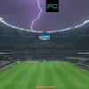
Large hail was spotted near Sublette, Illinois as severe weather moves through the Chicago area on Tuesday night.
Click here to watch our live radar
The cluster of storms is bringing heavy downpours, a huge amount of lightning and large hail. But they are moving extremely quickly from west to east, and are expected to be totally clear of the area by about 10 p.m.
The system had started weakening as it continued traveling east by 6:40 p.m. but the potential for the storms to be severe was not over.
Scott advised everyone to make sure they have a severe weather plan in place in the event of storm damage and tornado warnings.

SEE FULL FORECAST: Accuweather Alert | PM showers and storms Tuesday
After the storms leave, the area will experience a rapid temperature drop, with wind chills potentially in the single digits Wednesday morning. There could also be snowy and icy conditions for the commute Wednesday morning.
Chicago area sees near-record high temperatures
For a day, Chicago felt more like June than February and people got out of their houses and into the city to enjoy the warm weather.
Chicago nearly broke the record for temperatures Tuesday, feeling more like June than February.
Two friends took the train in from Joliet to play chess by the Chicago lakefront. Others decided to trade ice skates for roller skates before the cold front moved in.
The Riverwalk was buzzing with people during lunch, a rare sight during a month that usually has us hunkered down.
On the North Shore, the warm up made a big splash, with one swimmer taking a morning dip in Lake Michigan.
Many getting out and soaking up the sun, on a day when temperatures easily reached the mid-70s..
"I think you just feel happy especially whenever the sun is out and we had all of probably three weeks in January where we didn't see the sun," Melissa Field said.
John and Sandy Lyons brought their breakfast to Lakefront Park in Glencoe to enjoy the unseasonably warm weather.
"I hope it stays here until June," John Lyons said. "This is just an amazing winter that we're having and this weather and in February has been perfect."
Just a few blocks away at Hometown Coffee and Juice, Lou Lubin opened up the windows for his customers, many eager to eat outdoors.
"It's good for business obviously people want to get out," Lubin said. "It's winter time. It's 50, 60, 70 degrees so it makes it very, very busy."
Alex Nellessen chose to sit outside with his wife, dressed in a pair of shorts.
"We just dropped the kids off at school and we're like let's have a little morning brunch date together...al fresco exactly. can't beat this right now," Nellessen said.
Meanwhile, everyone's bracing for a huge temperature drop in the next 24 hours.
Wednesday the area could have wind chills in the single digits and as a cold front swoops in, storms, strong winds and hail could develop.
But Sandy Lyons is tuning all that out.
"I don't think we're gonna have any more snow and I don't believe in the hail they're talking about tonight either," Sandy Lyons said.
Copyright © 2024 WLS-TV. All Rights Reserved.